Second Place, 2015
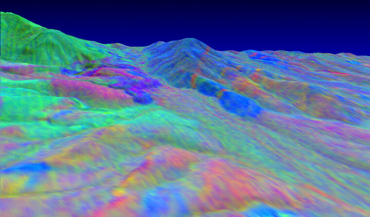
Thermal infrared multispectral imaging is a reconnaissance technique that discriminates between carbonate and silicate minerals using their distinct infrared emissivity at wavelengths from 8 to 12 micrometers. Made with NASA's Thermal Infrared Multispectral Scanner, this image of the southern Providence mountains in California depicts diorite roof pendants in blue, gold-bearing quartz monzonite intrusions in red, and sedimentary carbonates juxtaposed by faulting in green. The Vulcan Mine, in the center field, is an iron skarn hosted in carbonates, and was mined during the second world war by Kaiser steel for shipbuilding. Numerous small bonanza gold mines dot the region. To appreciate the geologic power of this technique, go online and compare with an aerial color photograph. The technique has been employed over Mars, where it is impractical to map the entire planet with robots or geologists.
Credit:
John Kuehne, Ph.D.
Research Associate, McDonald Observatory
(with special thanks to geologist Don Allen whose field work inspired the analysis)