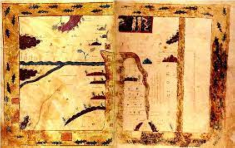
Beatus of Liébana, 776
Earliest surviving copy from 926CE.
Original size 51x36cm
From Morgan Library and Museum, New York, USA, Ms644
VIEWING AID
1) The Map is oriented with East at the top
2) It is a T-O form - in this case Europe and Asia on the left, and Africa/Asia on the right
3) The bottom half of the map is divided by the Mediterranean
4) Flowing into the Med from the left is the Black Sea and from the right is the Nile
5) On the top is Earthly Paradise
6) Between there and the Nile are Judea and Palestine
7) The oblong of land to the extreme right, separated by a sea, is an unexplored wilderness, because of the heat