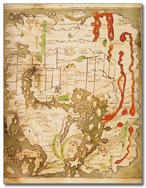
The Cottoniana, 995
This Anglo-Saxon map has been enlarged for better viewing (original 21x17cms)
From British Library, London, UK.
VIEWING AID
1) The map is oriented with East at the top
2) It is a T-O map centred on Jerusalem
3) Europe and Asia occupy the left, Africa the right
4) Britain is bottom left
5) Arabia and India, and a place with many lions, are at the top


