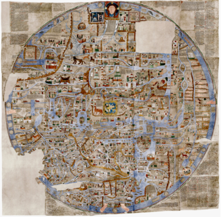
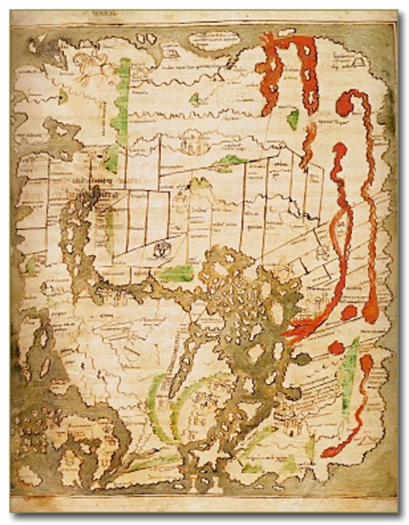
The Cottoniana, 995

This Anglo-Saxon map has been enlarged for better viewing (original 21x17cms)
From British Library, London, UK.
VIEWING AID
1) The map is oriented with East at the top
2) It is a T-O map centred on Jerusalem
3) Europe and Asia occupy the left, Africa the right
4) Britain is bottom left
5) Arabia and India, and a place with many lions, are at the top

Exhibited by:

SilkRoadVirtualMuseum

More from SilkRoadVirtualMuseum

Gotenjiku-Zu, 1364 , 1364 CE
177 x 166.5 x 0.1 cm (h x w x d)
SilkRoadVirtualMuseum
Vesconte World Map, c 1300 , c 1300CE
h = 100, d = 0.2 cm
SilkRoadVirtualMuseum
Hereford Mappa Mundi, c. 1300 , c. 1300CE
158 x 132 x 0.2 cm (h x w x d)
SilkRoadVirtualMuseum
Ebstorf Mappamundi, 1245 , 1245CE
132 x 129 cm (h x w)
SilkRoadVirtualMuseum
Psalter Map, 1250 , 1250CE
h = 150, d = 0.1 cm
SilkRoadVirtualMuseum