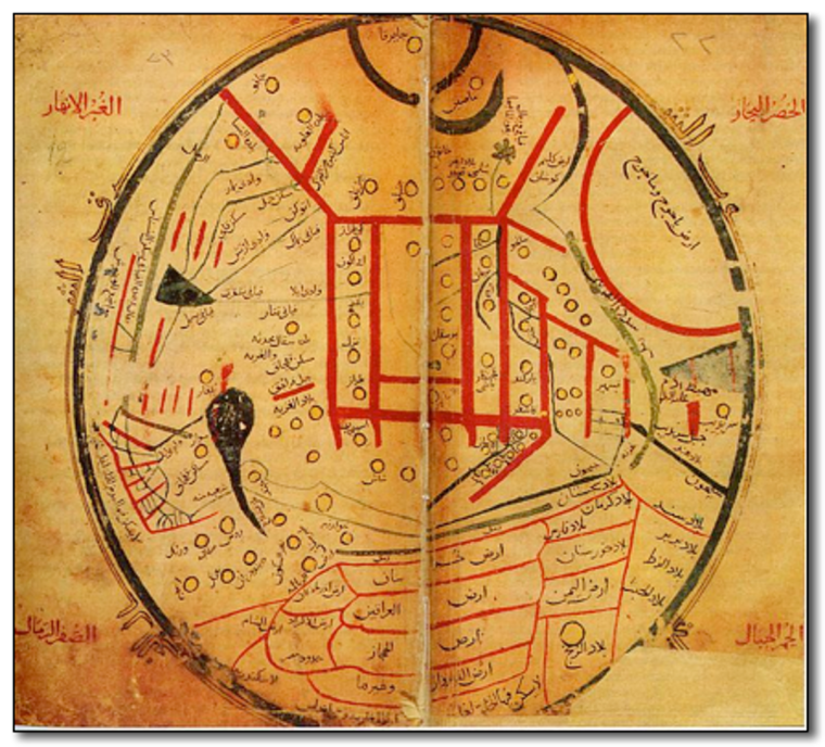
Al-Kashgari World map, 1050
This Arabic map has been enlarged for better viewing (original 46,2x42cms)
From Millet Library, Istanbul, Turkey
VIEWING AID
1) The map is oriented with North-East at the top
2) In the topmost circle is Japan, and below it, China
3) In the large semi-circle to the right of them is the land of Grog and Magog, horrifying creatures to be unleashed on Earth before the 'end of the world
4) Below that, after the V-índent if Sri Lanka
5) The map is centred on Kyrgyzstan
6) East Sahara is at the bottom
7) Russia is next to the inverted-P shaped Aral Sea