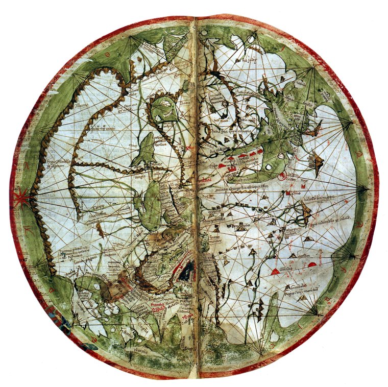
Vesconte World Map, c 1300
This map by a Genoese cartographer has been enlarged for better viewing (original diameter 35cms)
From British Library, London, UK. Ms 27376
Viewing Aid
1) Typical T-O map with East on top
2) The map is centred on Jeruslaem, but the space for the Holy Lands is no longer exaggerated
3) India and China are clearly marked at the top
4) Gog and Magog are still there, but there is no earthly paradise
5) Note the increased accuracy of the coastlines, probably employing nautical charts and map projections