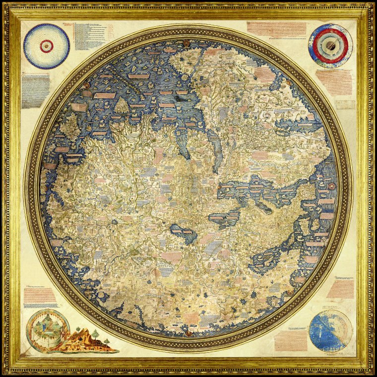
Fra Mauro Map, 1459
The work of a monk from Venice.
Original size 240cms diametre
From Biblioteca Nazionale Marciana, Venice, Italy.
Viewing Aid
1) Unusually for European maps, the map is oriented with South on top, possibly a reflection of the Arab sources he undoubtedly used.
2) The outline of Africa is more accurate than previous maps, reflecting the Portuguese
3) The map also appears to show the Cape of Good Hope, and the prospects of a passage between the Atlantic and Indian Oceans (again from Arab sources?)