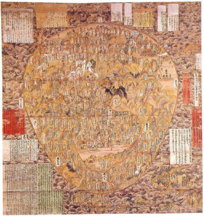
Gotenjiku-Zu, 1364

This is a Japanese Buddhist world map
Actual size 177x165cms
From Horyu-ji Temple, Nara, Japan.
VIEWING AID
1) The map is oriented with North on top, and with Turkestan as the northernmost location
2) The map is centred on Mount Meru,the five peaked mountain central to Hindu, Jain, and Buddhist cosmology
3) Japan features outside the mainland frame of the land mass (top right)

Exhibited by:

SilkRoadVirtualMuseum

More from SilkRoadVirtualMuseum

Auspicious grain
Ink and Colour on Paper
SilkRoadVirtualMuseum
Dwelling in the Qingbian Mountains , 1366
Ink and Colour on Paper
SilkRoadVirtualMuseum
Thatched Cottage in Autumn Mountains , 1343
Ink and Colour on Paper
SilkRoadVirtualMuseum
Ge Zhichuan Relocating to the Mountains , 1360
SilkRoadVirtualMuseum
Cloudy Mountains , 1360s
Ink and Colour on Paper
SilkRoadVirtualMuseum