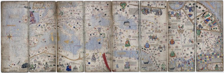
Catalan Atlas, 1375
Possibly the work of Cresques Abraham, a Jewish cartographer Original Size 50X258cms
From National Library, Paris, France.
VIEWING AID
1) The map is oriented to the North and split mid-length between Europe and Asia, with Jerusalem in the centre
2) Christain cities have a cross, others a dome. Political allegiance shown with a flag
3) Asian, Indian and Chinese cities are correctly identified, but there is no indication of Japan
4) Kings sit enthroned, armies march and caravans trade - so much to enjoy
5) Not for nothing seen as the pinnacle of medieval cartography